This page consists of part of Cowesfield Esturmy and is being progressively updated with more content as progress is made with finalising the contents of that page.
Introduction
Cowesfield Esturmy is a manor established in Saxon times that stretches in a line from just south of the Parish Lantern to Cowesfield Green and northwards to the ridge of Dean Hill. It was one of three Cowesfield manors and named after the Sturmid family to distinguish it from the other two. The other two Cowesfield manors were another Saxon manor Cowesfield Spilman and a Norman one Cowesfield Louveras.
As well as a map below, I've included a number of views along the A27 showing where Cowesfield Esturmy starts and ends on the road..
 .
.
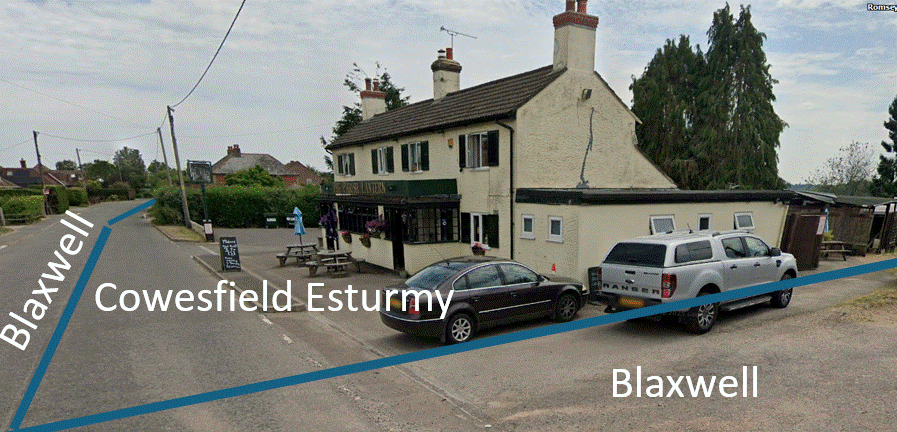
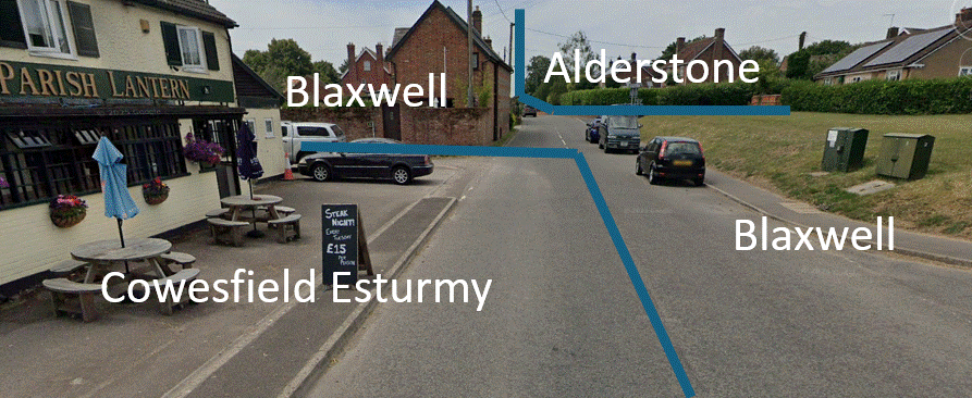
Manor boundaries at the Parish Lantern looking west and east
 .
. 
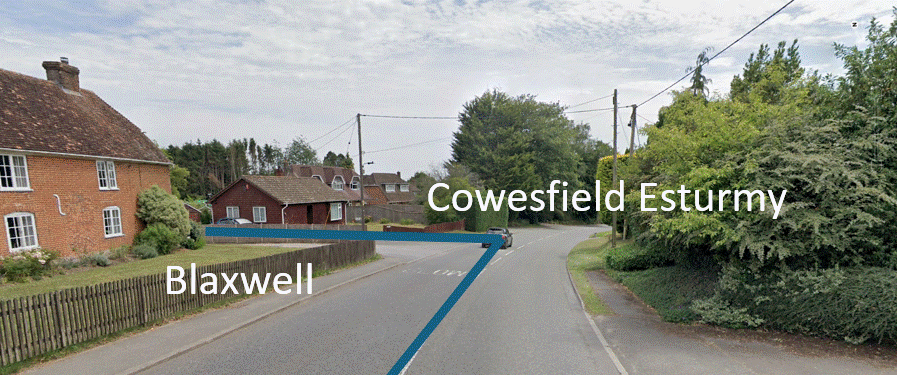
Manor boundaries at Pains Fireworks entrance and Cowesfield Green looking east
Cowesfield Esturmy ends at Parkwater Road on the right in this view
The two maps below show the extent of Cowesfield Esturmy manor and a more detailed view along the A27. Along the A27 the manor of Blaxwell lies to the west and Cowesfield Spilman to the east. The southeast corner of the manor butts on to Cowesfield Green and Cowesfield Wood, the remaining woodland and common grazing for the two manors of Cowesfield Esturmy and Spilman. At the A27 the boundary with Cowesfield Spilman runs along Miles Lane (Forty Acre Lane). Further north the boundary leaves Miles Lane at Dean Lodge and includes Mean Wood. On this northern section the manor of Alderstone lies to the west of Dean Lane and along the ridge of Dean Hill to the north.
 .
. 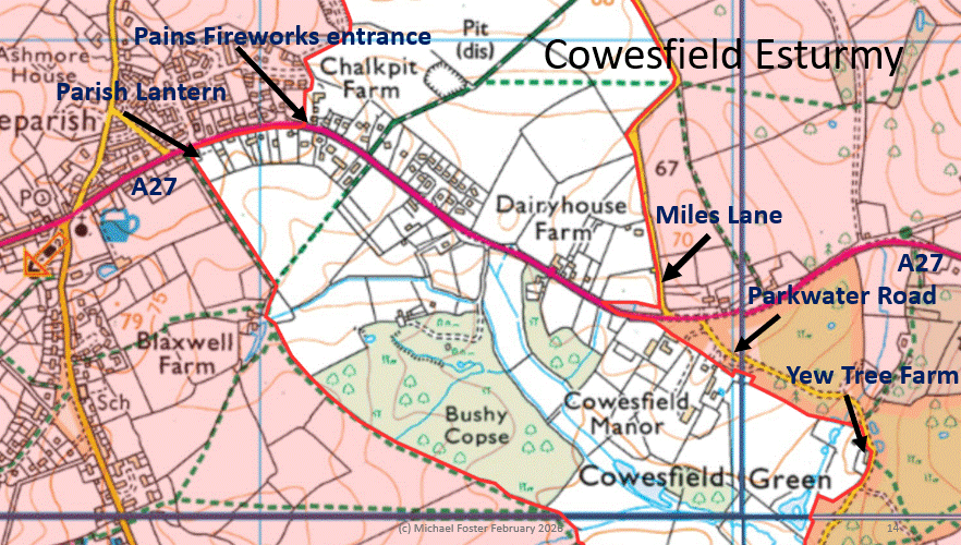
Cowesfield Esturmy outline map and detail along the A27
LEFT: The roads shown in red are the A27 from left to right, Common Road going south from it, Dean Lane and Miles Lane going north
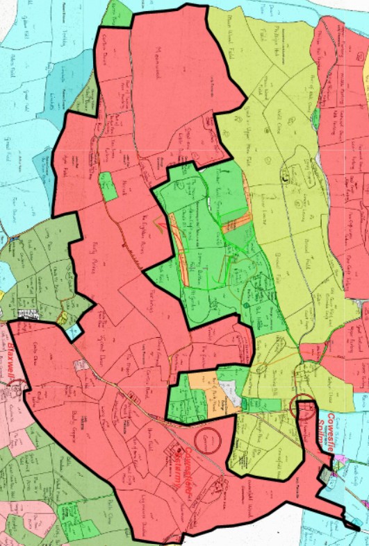
The extent of Cowesfield Esturmy based on land ownership in the 1842 Tithe Award, red Lady Fremantle, who also owned Cowesfield Louveras on the right edge of this map.
This map is overlaid on a tracing of the whole Tithe map made by Phoebe Merrick and understandably includes a few minor errors of labelling and tracing
See Tithe map manors and tithings and Tithe map landowners for maps that are kept updated with my own corrections